Johor
 |
 |
Johor has high diversity in ethnicity, culture, and language. The state is known for its traditional dance of zapin and Kuda kepang. The head of state is the Sultan of Johor, while the head of government is the Menteri Besar. The government system is closely modelled on the Westminster parliamentary system, with the state administration divided into administrative districts. Islam is the state religion per the 1895 Constitution of Johor, but other religions can be freely practised. Both Malay and English have been accepted as official languages for the state since 1914.
The economy is mainly based on services and manufacturing sectors. Johor is one of the main economic powerhouses in Malaysia and is currently among the top 4 contributors to the national gross domestic product, along with Selangor, Kuala Lumpur and Sarawak. It is also one of the most vital international trade centres in Malaysia, with Port of Tanjung Pelepas being the 15th busiest port in the world, as well as the busiest container port in the nation.
The area was first known to the northern inhabitants of Siam as Gangganu or Ganggayu (Treasury of Gems) due to the abundance of gemstones near the Johor River. Arabic traders referred to it as جَوْهَر, a word borrowed from the Persian گوهر (gauhar), which also means 'precious stone' or 'jewel'. As the local people found it difficult to pronounce the Arabic word in the local dialect, the name subsequently became Johor. Meanwhile, the Old Javanese eulogy of Nagarakretagama called the area Ujong Medini ('land's end'), as it is the southernmost point of mainland Asia. Another name, through Portuguese writer Manuel Godinho de Erédia, made reference to Marco Polo's sailing to Ujong Tanah (the end of the Malay Peninsula land) in 1292. Both Ujong Medini and Ujong Tanah had been mentioned since before the foundation of the Sultanate of Malacca. Throughout the period, several other names also co-existed such as Galoh, Lenggiu and Wurawari. Johor is also known by its Arabic honorific as دارالتّعظيم (Darul Ta'zim) or 'Abode of Dignity'.
Map - Johor
Map
Country - Malaysia
 |
 |
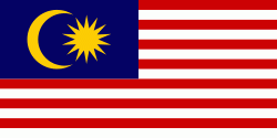
| Flag of Malaysia | |
Malaysia has its origins in the Malay kingdoms, which, from the 18th century on, became subject to the British Empire, along with the British Straits Settlements protectorate. Peninsular Malaysia was unified as the Malayan Union in 1946. Malaya was restructured as the Federation of Malaya in 1948 and achieved independence on 31 August 1957. The independent Malaya united with the then British crown colonies of North Borneo, Sarawak, and Singapore on 16 September 1963 to become Malaysia. In August 1965, Singapore was expelled from the federation and became a separate independent country.
Currency / Language
| ISO | Currency | Symbol | Significant figures |
|---|---|---|---|
| MYR | Malaysian ringgit | RM | 2 |
| ISO | Language |
|---|---|
| ZH | Chinese language |
| EN | English language |
| MS | Malay language |
| ML | Malayalam language |
| PA | Panjabi language |
| TA | Tamil language |
| TE | Telugu language |
| TH | Thai language |


